We are glad to announce that the Vegetation Map of the Galapagos v.2016 is ready and available for users. Please see the map and the implemented methodology -using drones- here.
Also, we just released the non-protected area 2020 map, using the same methodology as for the 2018 map, more details and shapefiles available here.
To obtain the shapefiles of this map, please write an email to grivast@usfq.edu.ec indicating if you need the native ecosystems map, invasive-dominated vegetation units or both, and also explaining what will be the uses you plan for this map.
In general, the main objective of this project is to use drones to help mapping non-native and native plant species in the archipelago. Under an active Galapagos National Park research permit, this pioneer project will also serve as the tool that will help to map the ecosystems of the islands. This investigation is part of a bigger research agenda that incorporates permanent in situ plots and climatic data to understand what is defining plant distributions in the archipelago and the future scenarios for plant’s colonization in this Ecuadorian province.
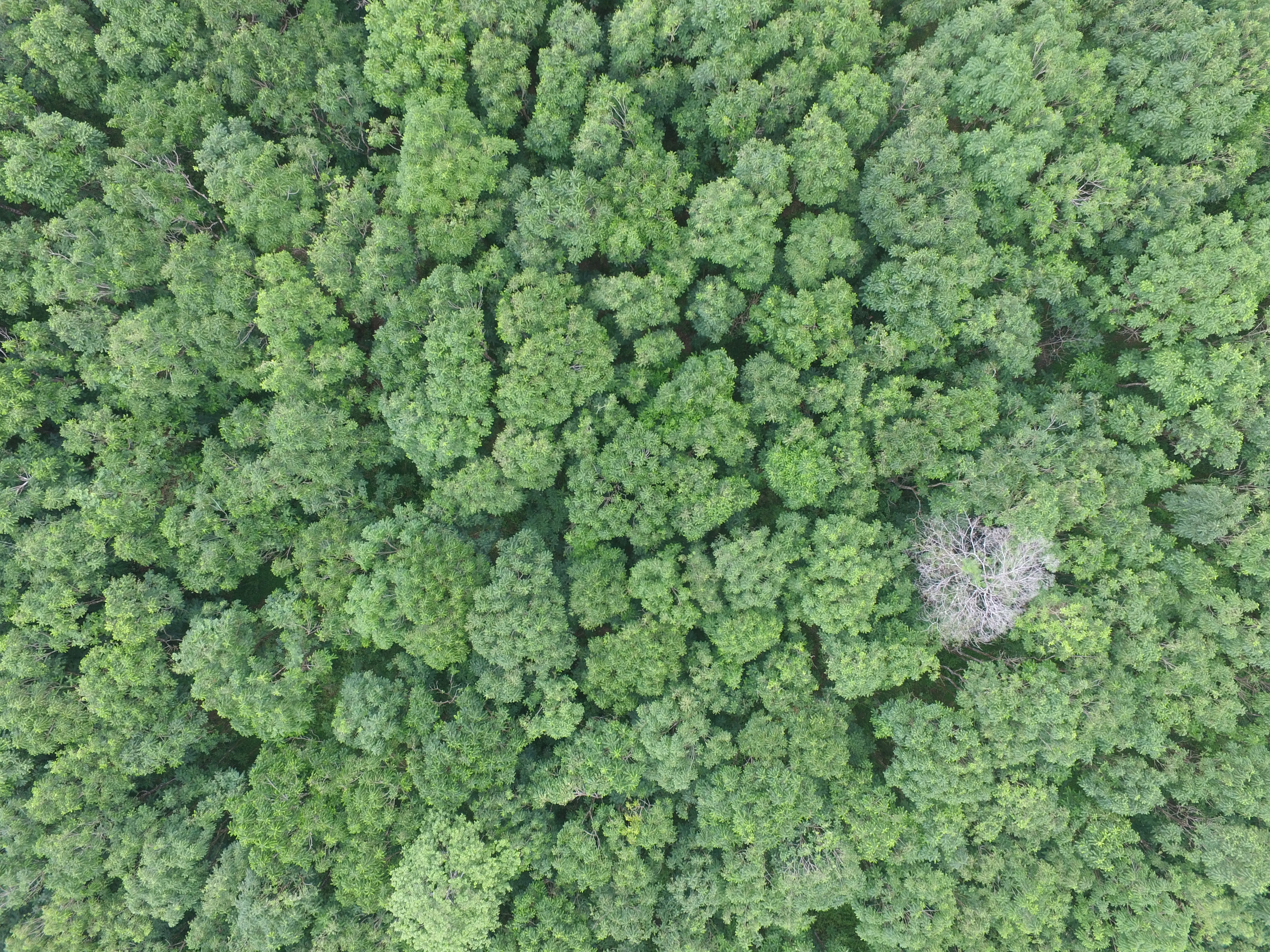
Above, the Cedrela odorata dominated forest taken from a drone. This is one of the invasive species we are collecting information (such as pictures) using drones and from other sources to define its distribution in the islands. This picture is from the forest located in the southwestern side of Santa Cruz island. G. Rivas-Torres (copyright).
The Galapagos National Park is working extensively on controlling and erradicating invasive species such as Cedrela, and have been very successful on preserving last extensions of threaten species like the unique Scalesia pedunculata. This endemic tree was extracted even before the creation of the National Park making its populations to face extinction. But, due to the hard work performed by the Galapagos National Park we can still have this tree and other unique species thriving in the archipelago.
El Parque Nacional Galápagos trabaja incansablemente para controlar y erradicar especies introducidas e invasoras como la Cedrela, y ha sido muy exitoso en preservar los últimos relictos de especies nativas amenazadas como el árbol Scalesia pedunculata. Este árbol endémico fue extraido y ha sido amenazado mucho antes que el Parque Nacional fuese creado haciendo que sus poblaciones esten amenazadas desde hace mucho tiempo. Pero, gracias a la ardua tarea del Parque Nacional y sus guardaparques podemos todavía tener a estas y otras especies únicas sobreviviendo en el archipiélago.
Here the link to the latest videos explaining more this work.
These maps wont be only a picture of the present, but will be updated under strict protocols to be able to quantify future and historical changes in the vegetation of this World Heritage Site. These protocols follow the accepted and official methodology endorsed by the Ministry of Environment of Ecuador and therefore the Galapagos National Park, the local authority in charge of regulating biodiversity distribution data in the country.
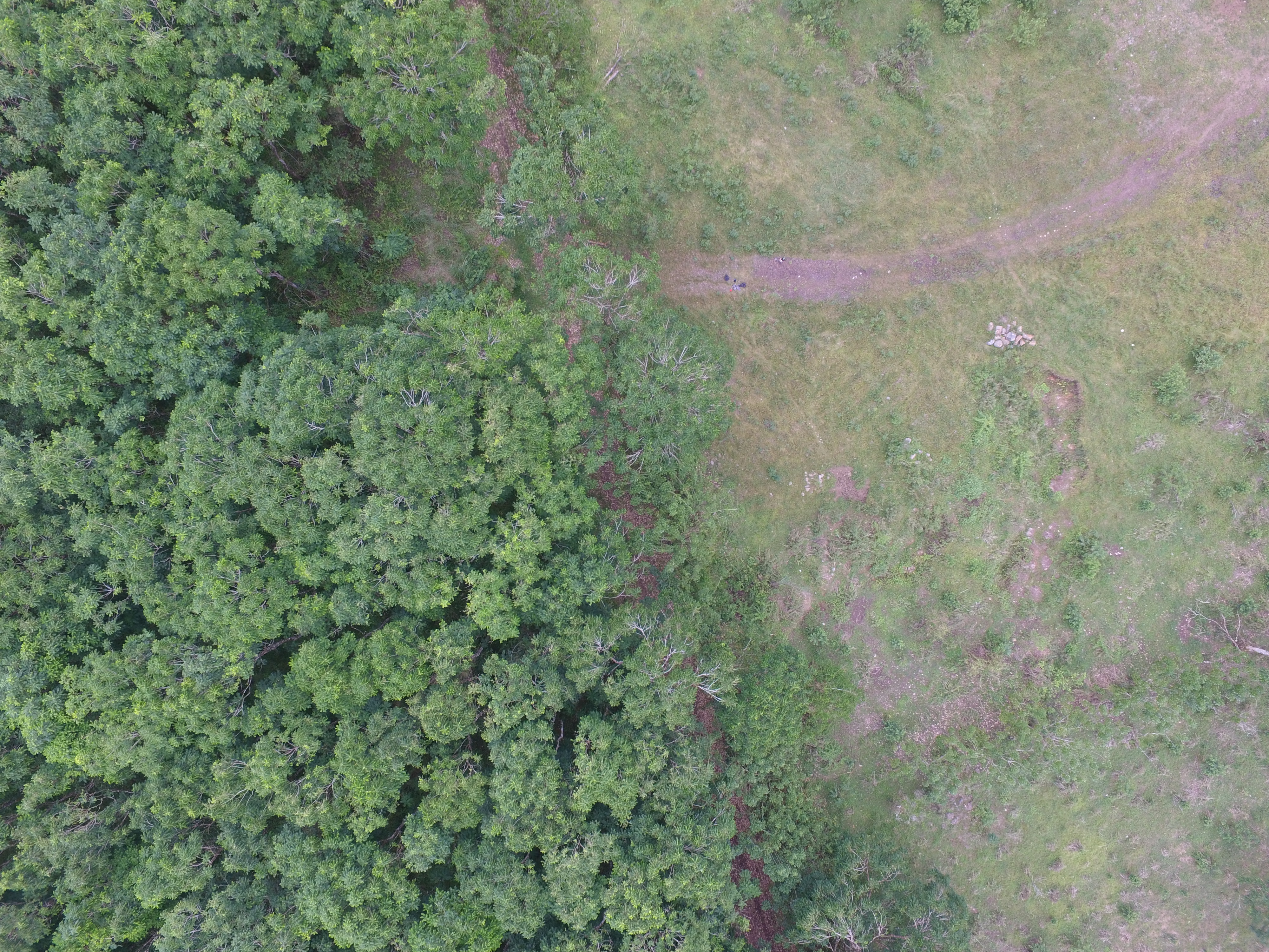
HD image from a drone flying over Santa Cruz island showing on the right: the agricultural land, and on the left: the buffer zone of the protected area of the Galapagos National Park (the road in the middle is the actual boundary between both zones). This area of the buffer zone invaded by Cedrela odorata, can be now spatialized to know its total extent and the conditions that allow its distribution. In a parallel fashion, we are mapping in the same island, regions dominated by native vegetation to perform similar quantitative analyses that will help for the managerial actions performed by the National Park. G. Rivas-Torres (copyright).
This means the data gathered by this project will be of significant scientific value, but will also serve as a tool for the managerial actions performed by the national regulatory entities. For example, among the many results of this investigation, future climatic scenarios will be used to understand the potential distributions of highly invasive and threaten endemic plants to help the Galapagos National Park in their conservation and monitoring actions.
This project is developed in collaboration with the Galapagos Science Center USFQ-UNC and the Galapagos National Park.
G. Rivas-Torres (copyright). 
G. Rivas-Torres (copyright). 
G. Rivas-Torres (copyright). 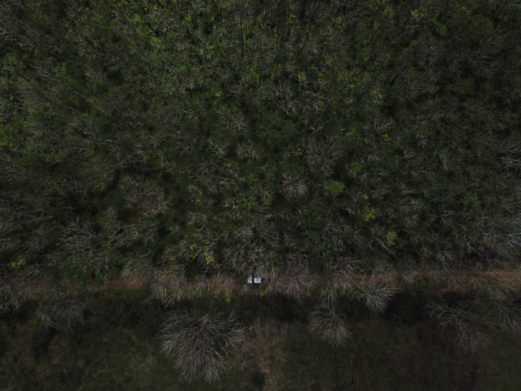
G. Rivas-Torres (copyright).
